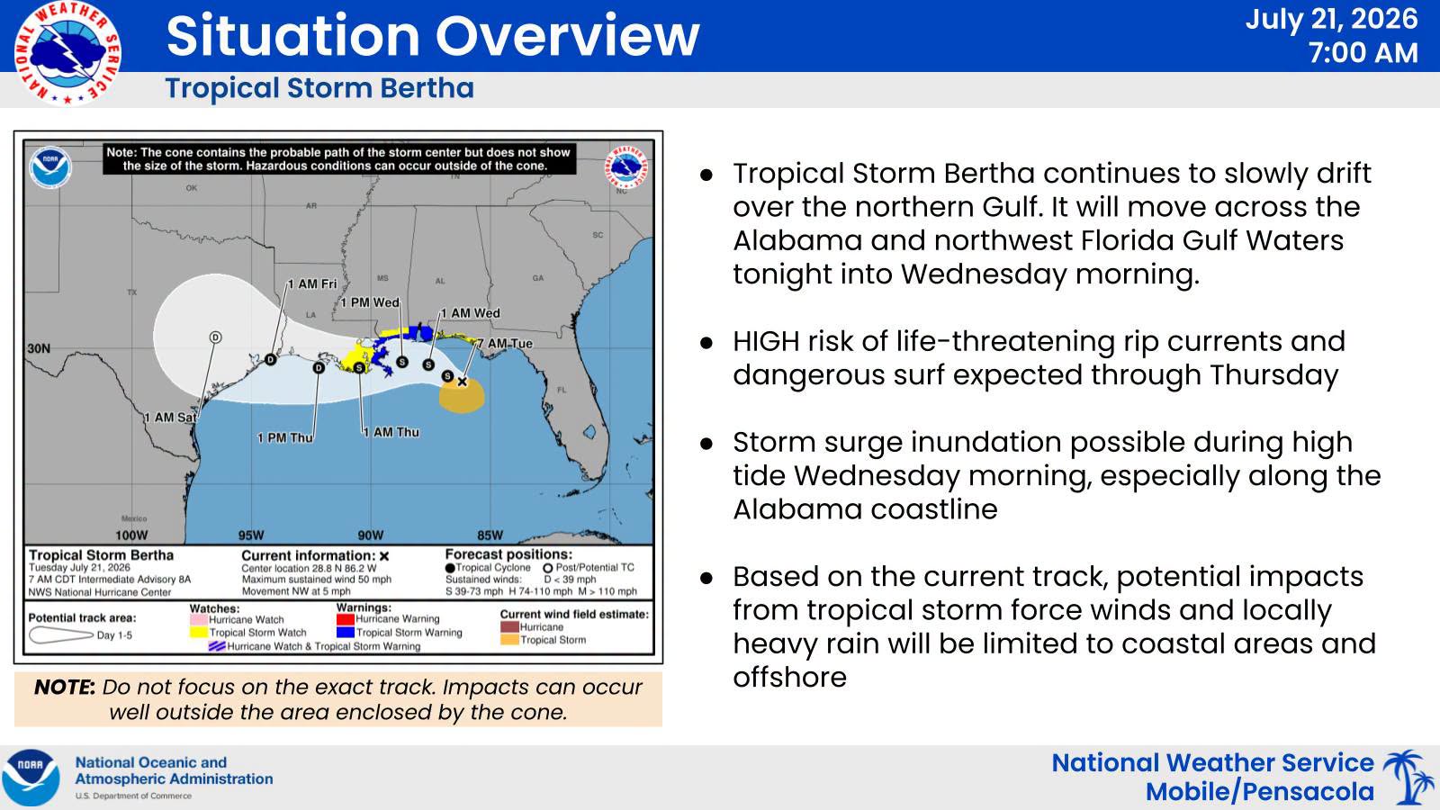
Overview According to the latest advisory from the National Weather Service Mobile, Tropical Storm Bertha is currently located about 130 miles south‑southeast of Pensacola and moving northwest at 5 mph, with maximum sustained winds near 50 mph. Bertha continues to battle shear and dry air, so only limited strengthening is expected. However, coastal and marine conditions will deteriorate over the next 24 hours as Bertha makes a close pass south of the Alabama coastline on Wednesday. Most heavy rainfall remains offshore, with coastal hazards presenting the greatest concern.
Key Messages
• A Tropical Storm Warning is in effect for coastal Alabama; a Tropical Storm Watch continues for coastal northwest Florida. • A Storm Surge Watch remains in place for coastal Alabama, including southern Mobile Bay — storm surge potential 2–4 feet; 1–2 feet possible along the western Florida Panhandle. • High risk of life‑threatening rip currents through at least Thursday night. • High Surf Warning from this afternoon through Wednesday night with dangerous breaking waves of 8–11 feet. • Brief heavy rain and tropical‑storm‑force winds possible in outer rainbands, mainly near coastal areas. • Track shifts remain possible and may alter expected impacts slightly.
For Your Awareness:
Sand is available: located at the Baldwin County Central Annex (22251 Palmer St. Robertsdale, AL 36567). This is "self-serve". Please bring your own bags and tools if you need sand.
Preparedness Tips:
Have multiple ways of receiving correct information from National Weather Service of Mobile, Baldwin County EMA, and your local news outlets.
Know your risks and potential impacts. Know your location on a map, your evacuation zone and potential evacuation routes.
Have any necessary supplies gathered to be self-sufficient for 5 days. Don’t forget medications and pet supplies.
Review important documents and insurance policies. Make sure you have flood insurance if needed.
Make an emergency plan and ensure all family members know how to contact each other and where to meet in case of an evacuation.
Steer clear of misinformation (especially on social media). Have multiple forms of receiving CORRECT information. (Baldwin County EMA, National Weather Service of Mobile, Local media outlets, etc.)
Monitor daily beach conditions and be aware of flag warnings. For a daily beach report, text ALBEACHES to 888777.
BCEMA and local officials are monitoring conditions and will update as any new information becomes available through National Weather Service of Mobile.
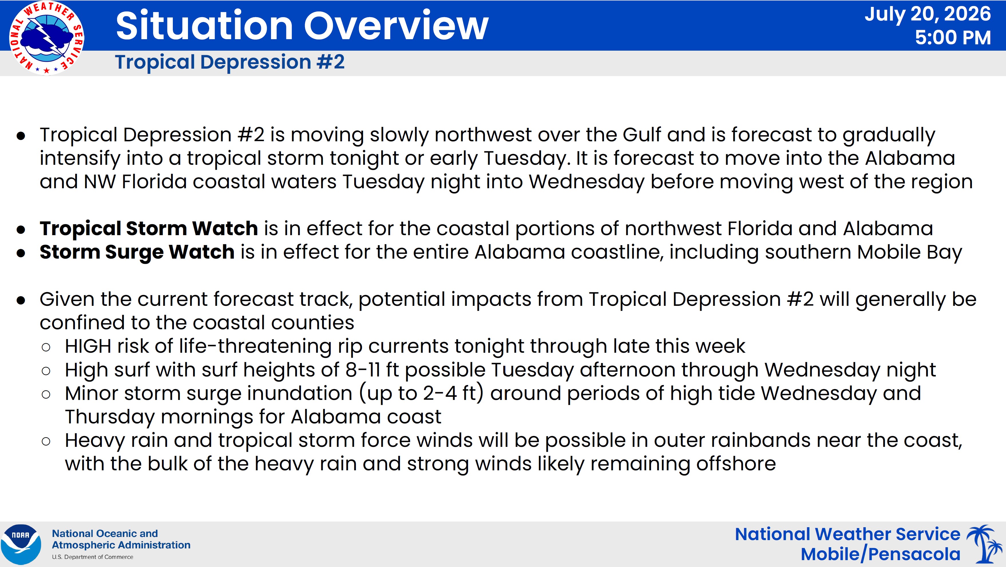
Tropical Depression Two is currently located approximately 105 miles south of Panama City, Florida, drifting slowly northwestward. The system is expected to strengthen into a tropical storm tonight or early Tuesday morning. Forecast guidance shows the system moving across the offshore waters of Alabama and the western Florida Panhandle from Tuesday afternoon into early Wednesday before continuing westward.
A Tropical Storm Watch remains in effect for coastal Alabama and the western Florida Panhandle coast, including coastal waters out to 20 nm. A Tropical Storm Warning is now in effect for the coastal waters from 20–60 nm offshore. A Storm Surge Watch has been issued for coastal Alabama. A High Surf Warning will go into effect Tuesday afternoon into the early evening. A High Risk of rip currents begins tonight.
Key Messages
• Tropical Storm Watch remains in effect for Alabama and western Florida Panhandle coastal zones and waters out 20 nm. • Tropical Storm Warning now in effect for offshore waters 20–60 nm. • Storm Surge Watch in effect for coastal Alabama with potential surge 2–4 feet; western Florida Panhandle may see 1–2 feet. • High risk of life-threatening rip currents beginning tonight. • High Surf Warning Tuesday afternoon into early evening with surf up to 10 feet. • Heavy rain and tropical-storm-force winds possible in outer rainbands, especially near the coast. • Any shift in track farther north could increase impacts across Baldwin County.
For Your Awareness:
Sand is available: located at the Baldwin County Central Annex (22251 Palmer St. Robertsdale, AL 36567). This is "self-serve". Please bring your own bags and tools if you need sand.
Preparedness Tips:
Have multiple ways of receiving correct information from National Weather Service of Mobile, Baldwin County EMA, and your local news outlets.
Know your risks and potential impacts. Know your location on a map, your evacuation zone and potential evacuation routes.
Have any necessary supplies gathered to be self-sufficient for 5 days. Don’t forget medications and pet supplies.
Review important documents and insurance policies. Make sure you have flood insurance if needed.
Make an emergency plan and ensure all family members know how to contact each other and where to meet in case of an evacuation.
Steer clear of misinformation (especially on social media). Have multiple forms of receiving CORRECT information. (Baldwin County EMA, National Weather Service of Mobile, Local media outlets, etc.)
Monitor daily beach conditions and be aware of flag warnings. For a daily beach report, text ALBEACHES to 888777.
BCEMA and local officials are monitoring conditions and will update as any new information becomes available through National Weather Service of Mobile.
Baldwin County Emergency Management Agency is encouraging residents and visitors of Baldwin County to monitor local weather and be prepared should we have direct impacts to our area. Now is a good time to review your plans and replenish any necessary supplies.
Overview:
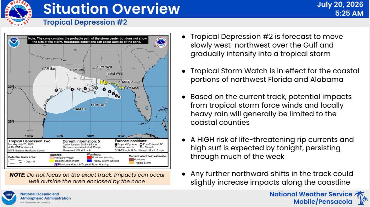
Tropical Depression Two is located south of the Florida Big Bend and moving slowly northwest. The system is forecast to strengthen into a tropical storm later today. While the overall forecast track remains consistent, a Tropical Storm Watch has now been expanded westward to include coastal Alabama, reflecting the potential for impacts within the next 48 hours.
Key Messages:
• Tropical Storm Watch: In effect for the western Florida Panhandle, the Alabama coast, and adjacent coastal waters. • Coastal Hazards: High risk of life‑threatening rip currents, 8–11 ft surf possible, and minor coastal inundation expected from Tuesday afternoon through Thursday morning. • Rain & Wind: Heavy rainfall and tropical storm‑force winds may occur in outer rainbands, mainly near the coast based on the current track. • Forecast Uncertainty: Any northward shift in the storm’s track could increase impacts across Baldwin County.
Please see graphic for more information.
For Your Awareness:
Sand is available: located at the Baldwin County Central Annex (22251 Palmer St. Robertsdale, AL 36567). This is "self-serve". Please bring your own bags and tools if you need sand.
Preparedness Tips:
Have multiple ways of receiving correct information from National Weather Service of Mobile, Baldwin County EMA, and your local news outlets.
Know your risks and potential impacts. Know your location on a map, your evacuation zone and potential evacuation routes.
Have any necessary supplies gathered to be self-sufficient for 5 days. Don’t forget medications and pet supplies.
Review important documents and insurance policies. Make sure you have flood insurance if needed.
Make an emergency plan and ensure all family members know how to contact each other and where to meet in case of an evacuation.
Steer clear of misinformation (especially on social media). Have multiple forms of receiving CORRECT information. (Baldwin County EMA, National Weather Service of Mobile, Local media outlets, etc.)
Monitor daily beach conditions and be aware of flag warnings. For a daily beach report, text ALBEACHES to 888777.
BCEMA and local officials are monitoring conditions and will update as any new information becomes available through National Weather Service of Mobile.